Riga
Rising in the Valdai Hills of Russia, the Daugava stretches for over 1000 km and passes through Russia, Belarus and Latvia before entering the Baltic Sea at the Gulf of Riga. The river itself forms part of the international boundary between Latvia and Belarus.

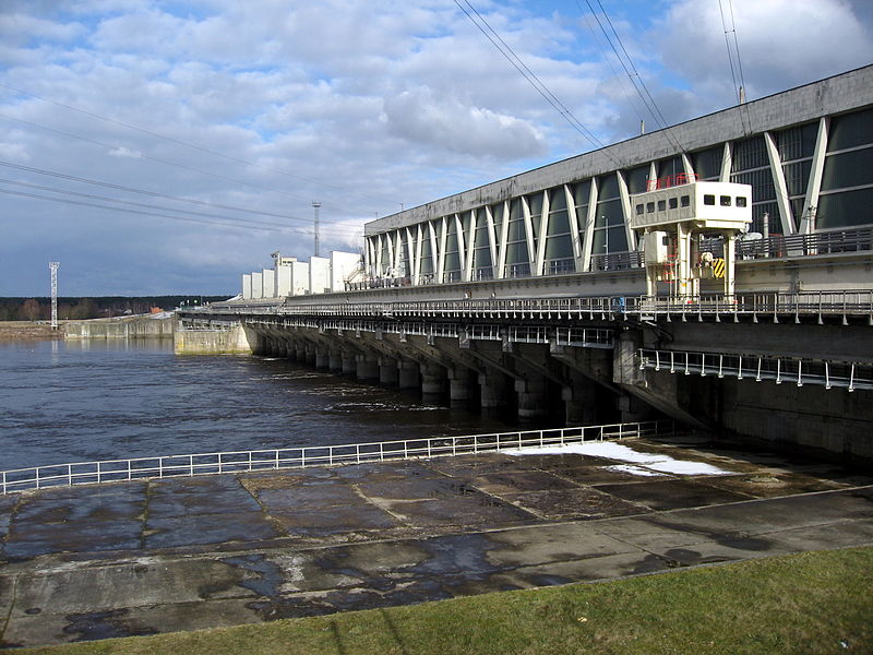
There are 3 hydroelectric dams on the river in Latvia and Belarus are also planning to build a series of dams on the river in their country. A fourth dam project near the Latvian city of Daugavpils is planned but has faced strong criticism.

Rigas HEP
The Daugava's catchment area is around 87,900 square kilometers, most of which is in Belarus.
The name Daugava comes from the ancient Baltic for the words "the great water" or "daudz udens". The name first appeared in the Viking sagas and the alternate name for the river "Dvina" comes from the Indo-European word for river.
The river as it makes its journey, passes through several cities, towns and settlements. In Russia these include Andreapol and Velizh. In Belarus it passes through Ruba, Dzisna and Beshankovitchy aamong others. In Latvia many towns were built on the Daugava's banks including Riga, Daugavpils, Lielvarde and Ogre.
Daugavpils
The Daugava river is so important in Latvian culture and identity that it is also known as the River of Destiny and even Mother Daugava. Its importance in antiquity was that it was one of the only ways that the northern vikings could trade with the southern European powers such as Greece. Riga became a strategic stopping point on that journey.
The relationship of the citizens of Riga to the Daugava was always
complicated. On the one hand, the river allowed navigation and the
transporting of freight, enabled the control of transit, and defended
Riga from aggressors. Fishing was also important.
However, there were also some inconveniences, among them the threat of annual spring floods. The most destructive flood took place 1709. In that year the winter was very severe, the entire Baltic Sea was frozen and ice thickness in the Daugava reached 1.73 m.
Ice started drifting in the Daugava at the beginning of April, but the Gulf of Riga remained frozen. Ice became crowded in the river mouth and the level of water in the river sharply increased and it overflowed its banks. The ice blocks broke the city gates, and the river flooded the streets. Since that time, a small brass plate embedded in the wall of the Dome Cathedral has marked how high the water reached inside the Cathedral - 4.68 m on 13 April, 1709.

So important is the Daugava to Latvian identity and its cultural heritage, a great many songs and stories are about the river. Click on the link here to listen and see 50,000 people singing one of these songs.
#daugava #riga #latvia
However, there were also some inconveniences, among them the threat of annual spring floods. The most destructive flood took place 1709. In that year the winter was very severe, the entire Baltic Sea was frozen and ice thickness in the Daugava reached 1.73 m.
Ice started drifting in the Daugava at the beginning of April, but the Gulf of Riga remained frozen. Ice became crowded in the river mouth and the level of water in the river sharply increased and it overflowed its banks. The ice blocks broke the city gates, and the river flooded the streets. Since that time, a small brass plate embedded in the wall of the Dome Cathedral has marked how high the water reached inside the Cathedral - 4.68 m on 13 April, 1709.
1929 Riga flooding
So important is the Daugava to Latvian identity and its cultural heritage, a great many songs and stories are about the river. Click on the link here to listen and see 50,000 people singing one of these songs.
#daugava #riga #latvia
No comments:
Post a Comment